I remember that someone posted on OTLand tool that combined 2 JavaScript/TypeScript libraries:
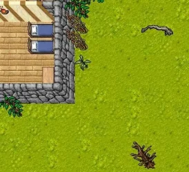
and made tool that was able to render PNG screenshots of given position (x,y,z) from .otbm map in web browser like:

I cannot find it on OTLand now.
Does anyone remember how was it called or has link to it's github?
I'm talking about JavaScript/TypeScript tool. Not mine C++ OTClient that does this ( GitHub - gesior/otclient_mapgen: Open Tibia map images generator [for LeafletJS]. Loads .otbm file and generate .png images 256x256 px (https://github.com/gesior/otclient_mapgen) ).
- GitHub - Inconcessus/OTBM2JSON: OTBM2JSON - A generic framework for programmatic modification of OTBM files. (https://github.com/Inconcessus/OTBM2JSON)
- GitHub - gesior/open-tibia-library: Library to manipulate files used by OTS and OTClient. Written in TypeScript. (https://github.com/gesior/open-tibia-library)
and made tool that was able to render PNG screenshots of given position (x,y,z) from .otbm map in web browser like:

I cannot find it on OTLand now.
Does anyone remember how was it called or has link to it's github?
I'm talking about JavaScript/TypeScript tool. Not mine C++ OTClient that does this ( GitHub - gesior/otclient_mapgen: Open Tibia map images generator [for LeafletJS]. Loads .otbm file and generate .png images 256x256 px (https://github.com/gesior/otclient_mapgen) ).
