
You are using an out of date browser. It may not display this or other websites correctly.
You should upgrade or use an alternative browser.
You should upgrade or use an alternative browser.
[Archived] "[Quick Showoff] Post your latest maps"
- Thread starter Xenios
- Start date
- Status
- Not open for further replies.
Eternal
Active Member
- Joined
- Aug 3, 2008
- Messages
- 136
- Reaction score
- 29
What OT is that for?
Click the image and find outWhat OT is that for?
")


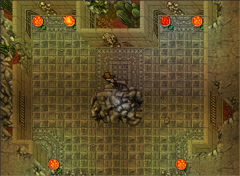
eiserne festung
EmfF
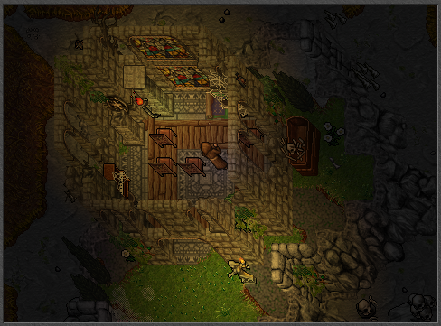
Adorable !!! and the windows 
but now... the mountain doesn't fit to the walls!!!
GET NEW MOUNTAIN SPRITESSSS !!!!!
but now... the mountain doesn't fit to the walls!!!
GET NEW MOUNTAIN SPRITESSSS !!!!!
SentieloNL
Member


Last edited:

Looks alright despite the bordering, but those new sprites are so shit that the bad bordering compliments it. xDWell I thought I should post something as I haven't in a long while.
And to everyone with simplistic borders


Left is the old map, Right is the current map, been working on it for a few hours, can't post ingame screens since I am having problems setting up TFS 1.0; anyways, old map has teleports and training monks to the southeast of town which I replaced, still not sure about the shape of the island, which is still not detailed, ofc


Oneda
Aspiring Spriter
Wont post as a IMG as its kinda big.
Link: http://puu.sh/7wQII.jpg
Have in mind that I'm kind of a starter in the mapping section, would appreciate some feedback.
Link: http://puu.sh/7wQII.jpg
Have in mind that I'm kind of a starter in the mapping section, would appreciate some feedback.
Wont post as a IMG as its kinda big.
Link: http://puu.sh/7wQII.jpg
Have in mind that I'm kind of a starter in the mapping section, would appreciate some feedback.
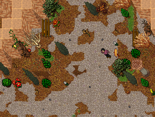
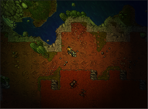
First off, let me be the one who say this, so nobody else can shitstorm about it without looking like an ass themselves. Don't zoom in when you take pictures.
With that said, I will start by pointing out something good.
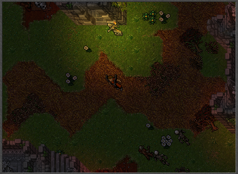
That pillar structure gives a bit of a history to the place. It raises questions such as "What was here before?", "What happened to that place?". An outlaw starting a fire on the only mountain nearby, visible both from the sea and plains is not an intelligent outlaw though.
")
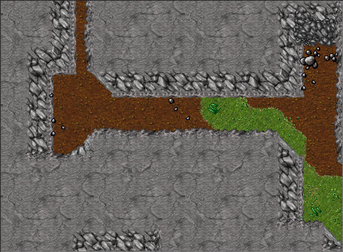
The mapping is very basic, but you MUST work on your borders. Using the palettes in RME can only get you so far, to get that extra touch to a place you might want to edit some things in raw. The part of the shore to the northwest is rater square. The dirt on the mountain lacks a border, the dirt on the east side is clearly autobordered, just fix the "end" of the path to make it look better. Also there are mountain borders under the ramp.
Other than those errors, the mapping itself doesn't look that bad. With a little work with the details and the things pointed out above you might have something really nice. Also don't forget to take a look at others pieces if not for inspiration, but for a look on how they solved a problem you might have with the appearance of the map.
- Status
- Not open for further replies.